More holes and other manufactured cloud geometry
More holes and other manufactured cloud geometry.
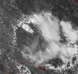
23 July 2005 2216Z The Grand Canyon and 23 July 2005 2130Z West Texas
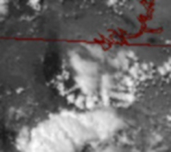
An established circle with what looks like a Peace sign developing within the circle's boundary; the chances of this happening naturally over the terrain of northern Arizona, Zero. A much larger formation growing over west Texas where at the periphery of the circle the storms are fed enough energy to form but still within small squares that seem to be the injection or withdrawal point for thunderstorm development.
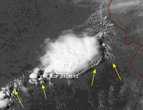
23 July 2005 2115Z East Central Missouri
A large storm complex growing itself by threading another series of boxes, squares/cubes, out to the southeast the direction of propagation. Two anchoring holes are arrowed to the west where the next in the series of thunderstorms will be spun-up. Inflow to the eastern edge of the storm is accentuated by the rippling as noted by the eastern most arrow.
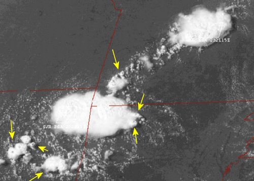
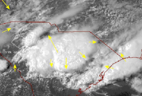
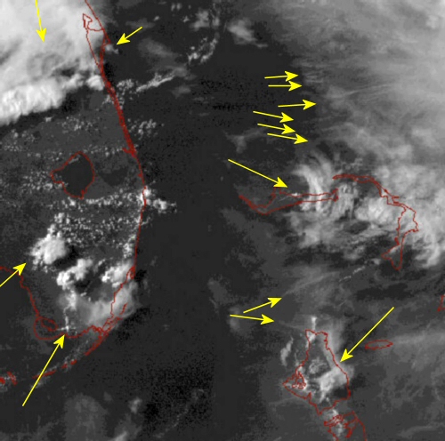
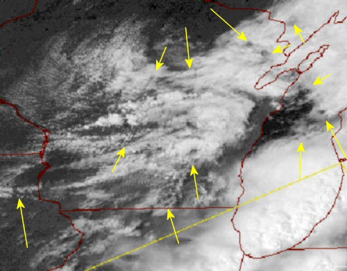
23 July 2005 2045Z Missouri, Arkansas and Oklahoma
Thirty minutes earlier than the image illustrated above. This pair of storm complex's will eventually develop a squall line between themselves. Notice all the small pairs of holes that will guide the development and movement of the storms through this day.
03 July 2005 2003Z The Carolinas
Large and unmistakable holes punctuate the skies over the Carolinas this Sunday afternoon. Where these holes form, their intensity and the associated weather they bring are of intense interest of the contrail marker planes. You can hear them flying overhead during the storms keeping tabs on the intensity of the weather.

23 July 2005 2045Z New Mexico
Just as the scalar technology began its deployment by the Soviets in the early to mid 1960's the first weather satellites came on line providing our first low resolution views of our daily weather from orbit. This has left a span of very little time to examine 'natural weather' via satellite imagery prior to contamination by this scalar weapons platform. What is interesting is that many of the images that are still up for public consumption show patterns, shapes, textures that are every bit as unusual as what we see today. But still very much different that what is seen today.
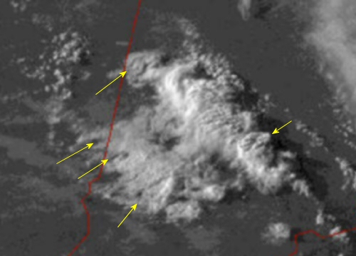
07 May 2005 2315Z West Central Indiana
A row of struggling thunderstorms with the waffle pattern of developing cubes across the top of the clouds. Spin-up holes are arrowed and obvious along the western flank. Larger holes are stacked N/S with the bottom one between the two rows of storms.
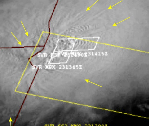
23 July 2005 1332Z Minnesota and eastern Dakotas
Three severe thunderstorm warnings are in effect at the time of this image as evidenced by the white boxes and the valid times listed. I count four and possible five sets of holes with the attendant rippling radiating out from the severe cells. This rippling is then bounded by radial sets of lines of which a few are arrowed.
23 July 2005 1845Z Off the Carolina Coast
A portion of the a western feeder band of Tropical Storm Franklin displaying some funky geometry while over the open Atlantic waters.
23 July 2005 2145Z The Florida Peninsula, The Bahamas...
... and Tropical Storm Franklin located just off to the east. The contrail marker program has taken many planes from the States and Canada and redeployed them to work the tropics during this record breaking start to the tropical storm season. Notice the numerous contrail/chemtrail lines marked in the upper right portion of the image. Starkly different imprints in the clouds over the Bahamas with the northern one rounded and arrowed, while the southern one is a nice square formation. Other oddities are arrowed across Florida... Note the symmetry with a cloud hole and a matched round cloud arrowed in the upper center of the image.
24 July 2005 1815Z West Virginia
Holes punched though the cloud cover litter the Virginias. Contrails are ususally seen criss-crossing these 5 to 30 mile wide openings.
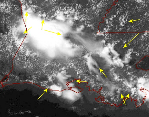
24 July 2005 1945Z Louisiana
More holes anchor square thunderstorm development in the humid summertime tropical environment of the Deep South.
27 July 2005 1945Z Montana
At this resolution, faint but evident patterns are visible. One, a rather broad circle, with rippling is seen at the northeastern most arrow.
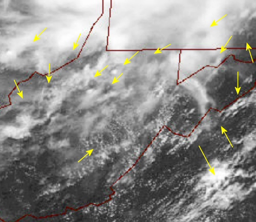
20 July 2005 2003Z Western Great Lakes
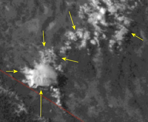
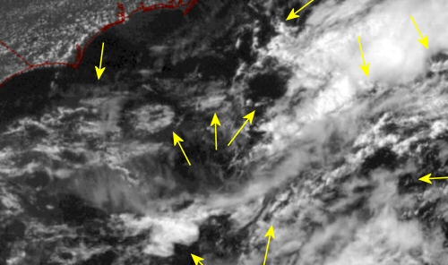
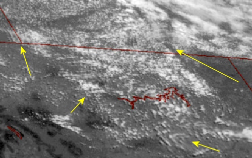
9 July 2005 0130Z Western Nevada
Odd oval imprints atop this lone mature thunderstorm cell. Plus some honeycomb shapes to the NE as the storm builds further.